
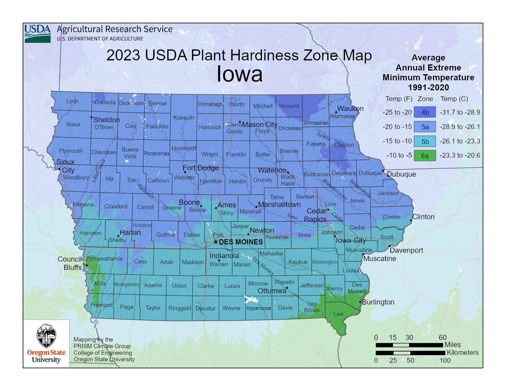
This article is all about Iowa growing zones. The USDA hardiness map below represents the different growing zones in Iowa. The map can help you identify what exact planting zone you live in.

Click here for full resolution USDA Iowa growing zones map
Iowa Planting Zones
You can determine growing zones in Iowa by looking at the map above and locating the approximate area in which you live. Then you can compare the color of your planting zone to those found in the legend to the right of the Iowa growing zones map.
This Iowa planting zones map is based on the 2023 updated version of the USDA planting zones map. This change was made mainly because of the recent climate changes, resulting in warmer climate zones in some areas that were previously cooler.
It’s hihghly recommended to take time to understand your Iowa growing zones so you can choose plants that will thrive in your area. By choosing plants suitable your zone, they will be better equipped to survive any upcoming harsh winter conditions.
Plants that are suitable for Iowa’s growing zones can be purchased from a local nursery.
Top Questions
Iowa is located in USDA Hardiness Zones 4, 5, and 6.
Most of Iowa falls within the Humid Continental climate classification, with varying climate zones within the northern portions of the state.
Iowa City, IO is located in USDA Hardiness Zone 5.
The average annual temperature ranges from 45°F in the north to 52°F in the southeastern corner of the state.
The average annual rainfall in Iowa is 32.66 inches, although the totals differ from year to year and across the various climatic regions of the state. Average precipitation varies from 26 inches in the uttermost northwest to as much as 38 inches in the southeast.
Sign up to get our FREE weekly emails
Gardening guides, tips, & videos delivered right to your inbox!

